
Walk a Kankakee Street by Address
A useful Kankakee street directory search moves from the physical place to records that name people. Start with the exact house number and street spelling. Kankakee County's DEVNET roll can return the tax owner, parcel identifier, legal description, assessed values, sale fields, and tax district data. K3-Mapper then shows the lot among adjoining parcels. Those two sources establish the mapped parcel and the name on the tax roll, not every person who lives there.
The next sources answer different questions. Recorder records connect grantors, meaning sellers, and grantees, meaning buyers, through recorded instruments. Illinois voter verification can test a named person's registration with date of birth, ZIP code, street number, and a street selected from the form. It does not publish an open roster for a whole block. Historical directories can add earlier names, but their year and address style must be preserved.
- Enter the street name and a low-to-high house-number range in the Kankakee County DEVNET Parcel Search. Record the PIN, situs address, owner display, and legal description.
- Open K3-Mapper, locate the same parcel, and inspect the lots on each side. Check municipal, zoning, flood, taxing, and election layers only as needed.
- If a particular person is being checked, use the official Illinois voter verification form with that person's required details. Do not treat a failed match as proof of absence.
- Search the Recorder's grantor-grantee index with the owner name and legal description. Follow linked deeds backward, noting dates and document numbers.
- For an older household, ask Kankakee Public Library about the nearest city-directory year, then compare the entry with census and newspaper evidence.
Search Kankakee Streets in DEVNET
DEVNET supports more than a single-address lookup. House Number Low and House Number High can define a range, while Street Name and City narrow the results. This makes it the strongest first tool for scanning ownership along a named street. A parcel number should be entered without spaces. Owner Name works best with the last name printed on the tax bill, and the portal advises entering at least one criterion.
| Street search field | Input | Best use | Portal note |
|---|---|---|---|
| House Number Low / High | Number range | Scan a block or street segment | Combine with street name |
| Street Name | Text | Find parcels by address | Use the roll's spelling |
| City | Text | Limit a shared postal label | Municipal status still needs GIS |
| Owner Name | Text | Test a known tax owner | Last name is the best start |
| Parcel Number | Text | Open one exact parcel | Enter without spaces |
| Sale Date / Price | Ranges | Narrow transfer activity | Optional filters |
| Legal Description | Text | Bridge old and new addresses | Exact subdivision text helps |
The inspected screen displayed a data timestamp of August 17, 2026. That stamp matters because a parcel card is a point-in-time assessment and tax record. A bank payment, transfer, or delinquency status may not appear at once, and a mailing address can differ from the parcel's physical location.
Read Kankakee Address Terms Correctly
The street number seen from the curb is only one property key. County files may rely on a PIN and a legal description, while the tax bill may go somewhere else. These terms prevent common mistakes in a by-address search.
- Parcel
- A mapped unit of land carried on the assessment roll, usually identified by a parcel identification number or PIN.
- Situs address
- The physical location assigned to the parcel. It is not the same as the owner's mailing address.
- Plat
- A recorded map that divides land into lots, blocks, streets, or other surveyed units.
- Criss-cross directory
- A directory arranged by street or address instead of by surname. No separately titled Kankakee run was confirmed, so ask the library before assuming one exists.
Ownership is not occupancy. A tax card may name an individual, business, estate, trust, or owner whose mail goes to another place. The Kankakee street directory trail becomes stronger only when independent sources agree and each source date is kept.
Map Kankakee Street Parcels
K3-Mapper adds shape and jurisdiction to the tax-roll list. The county GIS program maintains parcel and cadastral data, address points, municipal and township boundaries, taxing and election districts, unincorporated zoning, floodplain, and contour layers. Clicking a mapped parcel can help confirm which tax record belongs to a street number and whether adjacent lots share a subdivision or legal block.
The K3GIS data site also documents parcel and address datasets. Its address-point service is based on County Addressing Coordinator data from about 2017, so it should not be read as a live household list. The county warns that GIS data may change and carries no guarantee of accuracy, timeliness, or completeness.
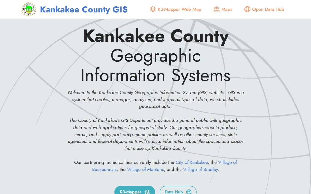
Use the map to check location and boundaries, then return to DEVNET or a recorded deed for names and dates. A point on a map is not evidence that a named person occupies the site.
Kankakee's 1854 Street Grid
Kankakee's first proposed town plat was filed on January 14, 1854. Its 49 blocks centered on the Illinois Central station and were bounded by Chestnut, Chicago, River, and Entrance. Additions doubled the area by the end of that year. This station-centered start helps explain why early address evidence often describes a side of a street, a corner, or two cross streets rather than a modern number.
No official citywide renumbering or street-renaming index was found. When an old address will not map, compare the recorded plat, deed legal description, city directory wording, and Sanborn sheet. County GIS, the Addressing Coordinator, City Planning, or Building and Code can help bridge a suspected change, but the change should not be guessed.
Kankakee Street Records Side by Side
No one county file is a complete Kankakee street directory. Each keeper records a different event, person, or property fact. The access column matters when a portal fails or does not reach the needed year.
| Address record | Custodian | Street evidence | How to reach it |
|---|---|---|---|
| Assessment and tax roll | Supervisor of Assessments / Treasurer | Tax owner, situs, mailing address, PIN, values | Free DEVNET search; office help |
| Parcel and address layers | Kankakee County GIS | Lot shape, adjoining parcels, districts, zoning | Free K3-Mapper; GIS office |
| Deeds, liens, and plats | Kankakee County Recorder | Named parties, transfer, legal description, document number | Direct Search, Tapestry, Laredo, counter, or mail |
| Voter registration check | Illinois State Board of Elections / County Clerk | Verification for one known person and address | State form; Clerk for lawful file access |
| Permits and code files | City of Kankakee | Address-based project or case records | Ask department; submit Illinois FOIA request when needed |
| Historic directories | Kankakee Public Library | Dated name, trade, and street description | Genealogy room, microfilm, staff help |
The PIN and legal description are the best bridges between systems. A street spelling can change, yet a lot and block reference may persist. For older household work, the Kankakee city directory collections explain the available years and how their entries read.
Follow Deeds Along Kankakee Streets
The Recorder's online routes serve different needs. Direct Search displays land-record data without images and says its data trails current recordings by ten days. Tapestry offers pay-as-you-go grantor, grantee, date-range, and legal-description searching. Laredo is an account service with the same interface used at office workstations. For a one-time street search, begin with the tax-roll owner and exact legal description.
Recorder tip. Start with one owner, date, or legal-description field, then add detail only after reading the first result set.
The Recorder says its online indexes reach through 1984, while its FAQ sends research before 1989 to the office. That leaves a documented 1985 through 1988 handoff that must be confirmed rather than filled by assumption. Staff may help locate a record but do not perform a title search.
The Recorder Direct Search interface shows the no-image route for index data.
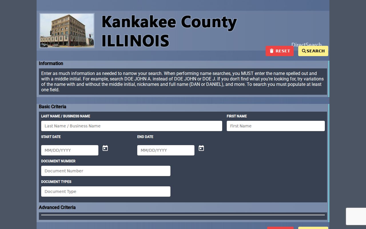
Capture the document number, type, recording date, parties, and legal-description reference. Then request the image or certified copy only if the task needs the document itself.
Kankakee Permit Records by Address
Building, planning, zoning, and code files can add a project or enforcement event to a parcel timeline. The research did not locate a public city permit or code-case search that accepts an address. The correct route is the responsible City of Kankakee department, followed by a written Illinois Freedom of Information Act request when the file is not routinely posted.
Describe the street address, parcel if known, record type, and a useful date range. Ask whether older material uses a prior number or legal description. City Planning maintains zoning maps and a revised November 2025 zoning ordinance, while county GIS supplies municipal and unincorporated layers. Those files describe land use and public actions, not a resident roster.
Decode Old Kankakee Street Entries
The 1876 directory makes street position part of the search. Entries use forms such as southwest corner, north side, west side, between, corner, and “See advertisement.” Some name a trade or business along with the person. Search both the surname and business, copy the compass wording, and check the page image because OCR may distort street names.
No confirmed Kankakee criss-cross run was found as a separate collection. Kankakee Public Library can check whether an address-arranged telephone or directory volume survives in the genealogy room. If none does, use the ordinary city directory, nearby census year, newspaper, Sanborn map, and deed as a combined historical reverse search.
Official Kankakee Street Search Screens
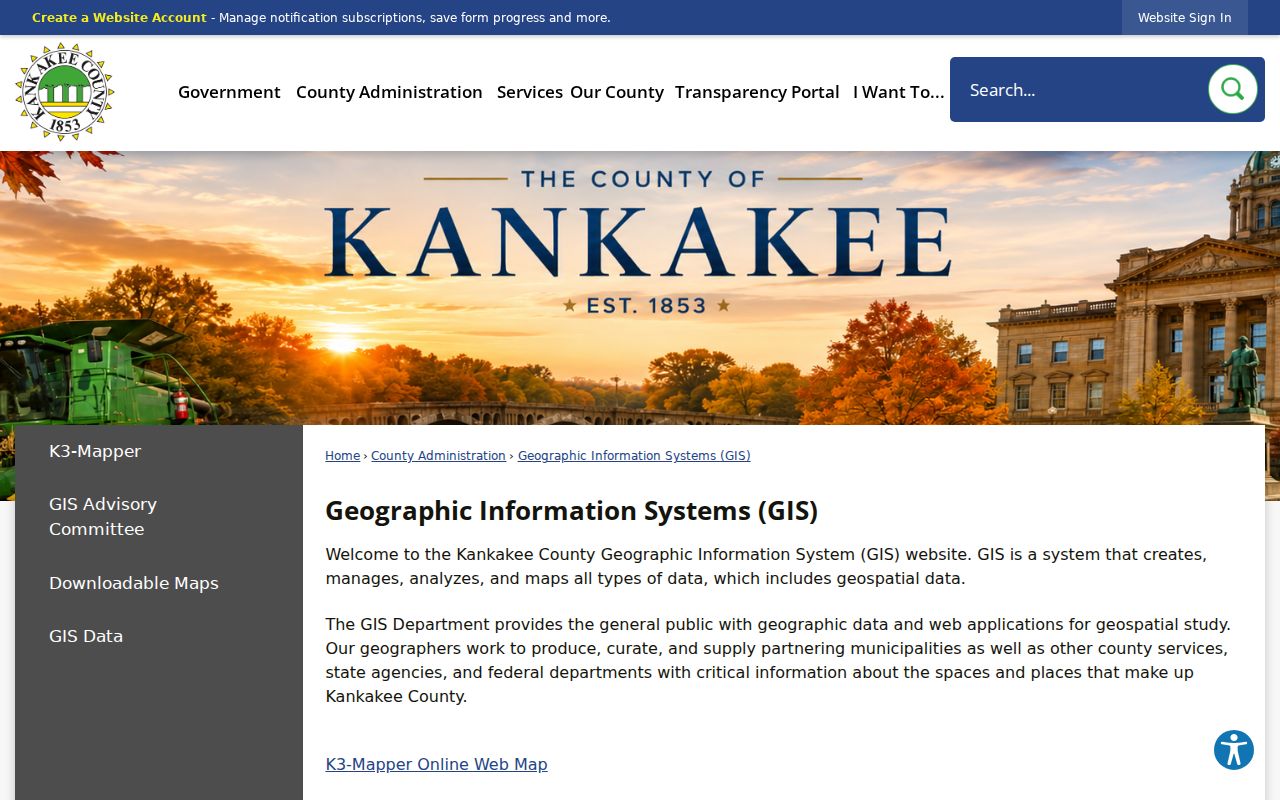
The Kankakee County GIS office page is the stable starting point when the interactive mapper changes.
For older deed work, the Recorder FAQ explains office help, title-search limits, and the historical counter route.
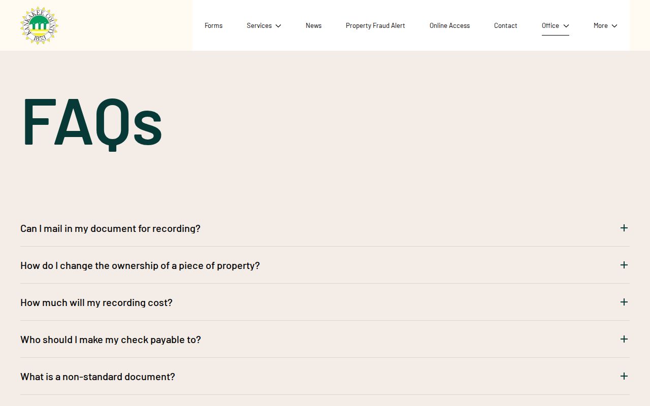
These pages are access guides. A search result still needs its own date, document number, and source notation.
Limits of a Kankakee Street Directory
Public property records do not name every Kankakee resident. DEVNET shows the tax-roll owner, not all occupants. A deed records a legal transfer, not who remained in the building afterward. The voter portal verifies one known registrant with required personal details and does not disclose a streetwide list. Driver and motor-vehicle addresses, utility customer data, protected voter information, and Address Confidentiality Program substitute addresses remain outside this workflow.
A missing portal result has many causes: a spelling variant, a recent transfer, an unindexed year, a mailing address used in place of situs, or a temporary service problem. Confirm the parcel, query date, and custodian before drawing a conclusion. Public files should support family history, property research, consumer safety, and civic understanding without turning a block into a private-household roster.
Lawful use. Use Kankakee address records only for lawful personal research. Never use a name or address to stalk, harass, threaten, or harm anyone.